 Floods
In our high rainfall area, we are used to heavy rains when crossings go under and we have to stay at home until the waters go down. Flooding is common. But in late February 2022 we learnt flooding can be life-threatening. We encourage everyone to explore this website and advise new residents to look here. On this site you’ll find links to:
- Floods in our community – introduction
- Your sources of flood information
- Terania-Keerrong Flood Safety Project – how it works
- Understand the difference between flood warnings and Rocky Creek Dam alerts
- Our citizen flood knowledge project- what we are learning
- How to prepare and act during the flood
- The CB Emergency Radio network
- Your resilient household is ready, isn’t it?
- Interactive map showing photos of flooding on our roads
- Flood response and recovery
Floods in our community – introduction
The Channon Village is the meeting point for 3 creeks. Terania Creek and Tuntable Creek merge just below the Tavern, while Rocky Creek joins Terania 1 km downstream. Terania Creek flows down the Keerrong valley. After this, Goolmangar creek joins Terania on its way to join Leycester Creek – which flows to Lismore. The Terania subcatchment is shown in this map.

Map showing the Terania sub-catchment
Which areas flood first in The Channon and surrounds?
As water drains down the flanks of our valleys it cuts the roads in various places. Homes – or groups of homes – become isolated on ‘islands’. The best source of information are the people who’ve lived here long enough to know which dips, culverts and bridges go under first…so get to know your neighbours! You can also check our interactive map to see how local bridges and culverts become affected during floods. If you create your own resilient household and communicate with your neighbours during floods for mutual support, you can manage nicely until the roads become passable. There are many spots that fill will water, but here are some of the main ones:
Along Terania Creek
Branch Creek Bridge is the first to go under, followed by the three large bridges (1st Bridge – Mulley’s Crossing, 2nd Bridge – Pooh Corner, and 3rd Bridge – O’Briens Crossing). Many smaller roads (and driveways) off Terania Creek Road get cut off, such as Black Rd, Ross and Lane Lawler Rd.
In the extreme flood of February 2022 some residents had to evacuate flooded homes on Terania Creek Road. One family was rescued by neighbours.
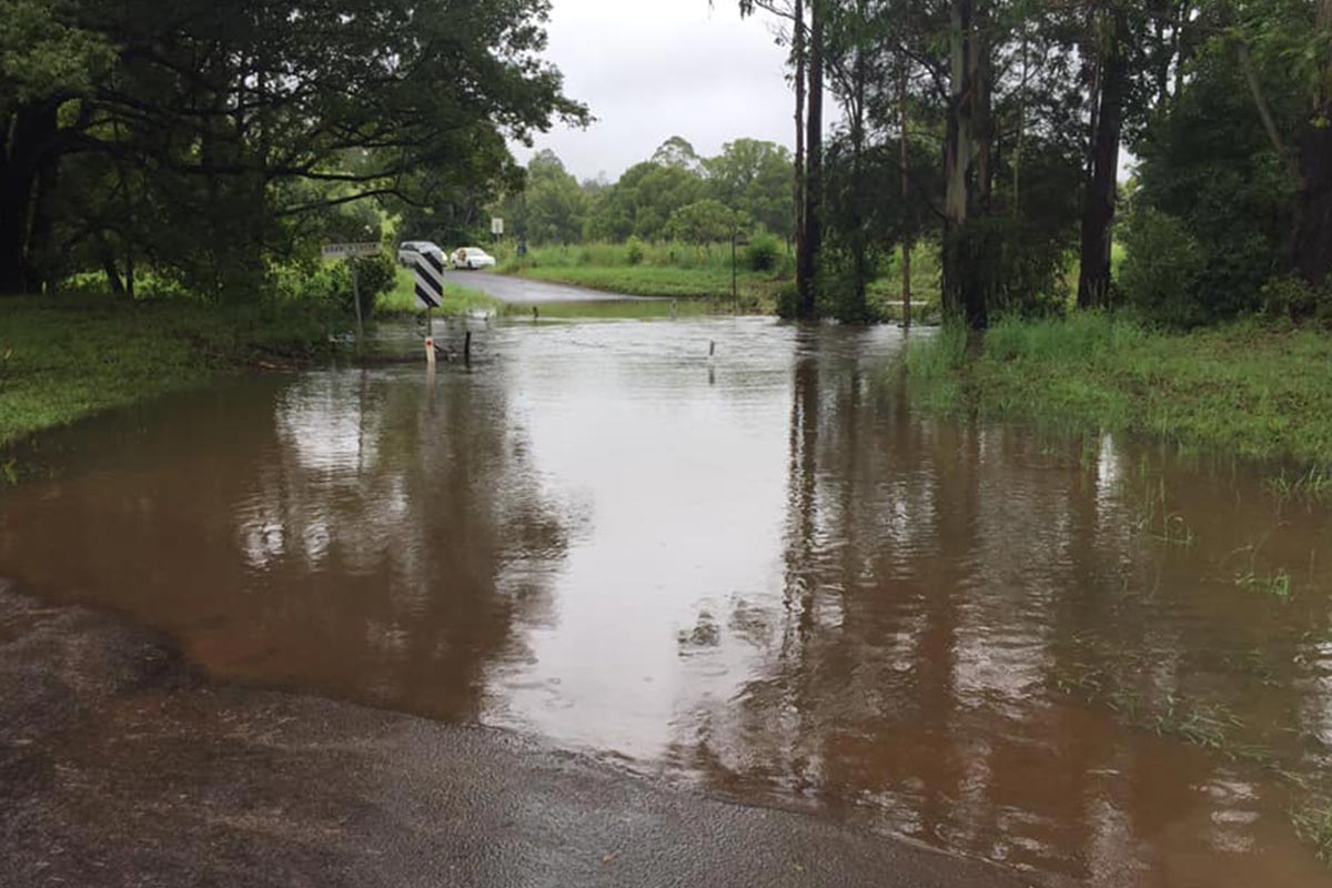
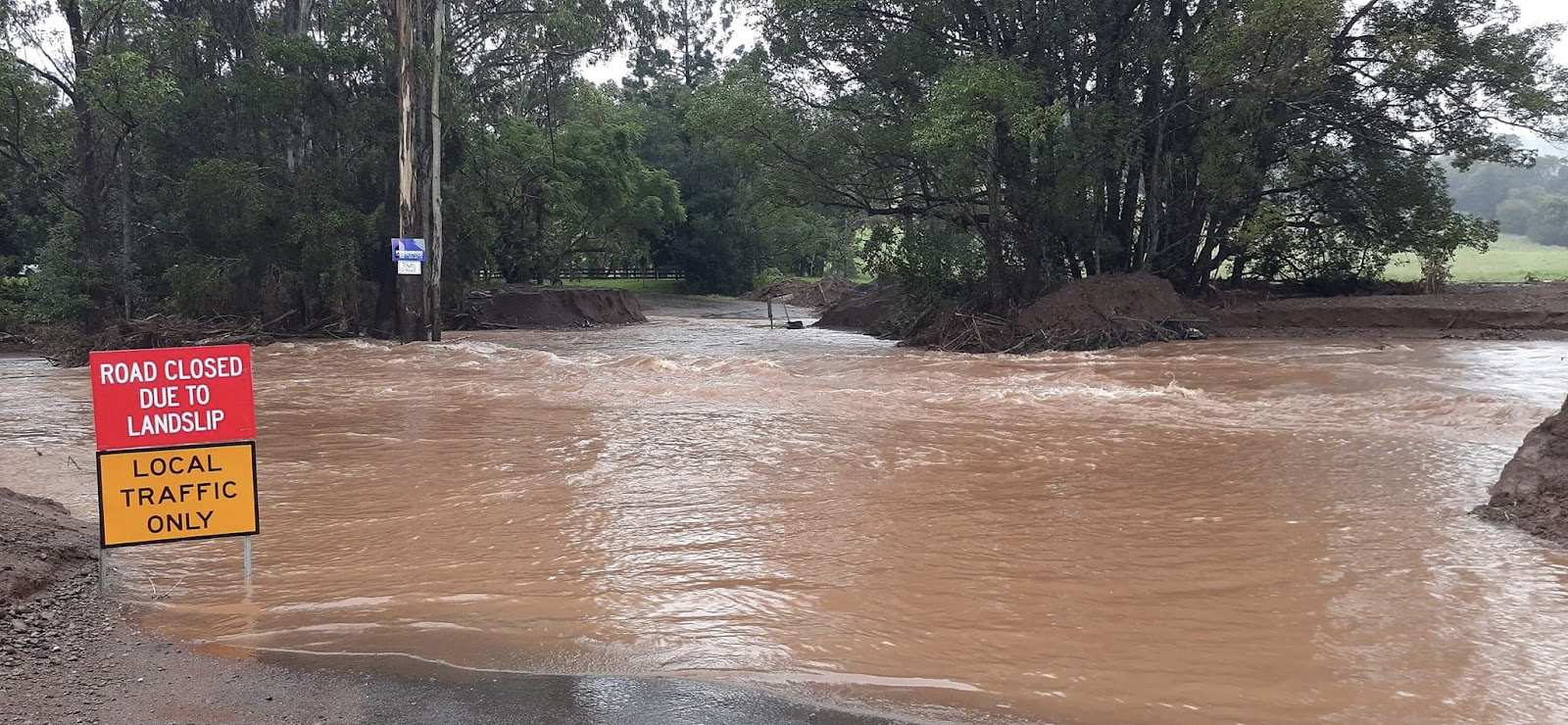
Photo left: Branch Creek Bridge cut in ‘normal’ flooding. Locals know this crossing becomes impassable in heavy rains. Photo right: For 10 days after the February 2022 flood, Branch Creek crossing was impassable and people were trapped without power or phone. See Resilient Households for practical steps to enjoy household independence during extreme events.
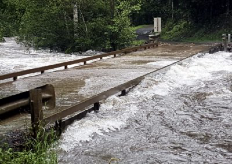
Photo: Terania Creek at 2nd Bridge. During heavy rains the creek can rise quickly.
Along Tuntable Creek
As with all our valleys, dips in the road fill with water at points of natural drainage. The crossings at Arkinstall Road and just past the Tuntable Primary School are especially prone to flooding. In the extreme 2022 flood some low-lying dwellings were flooded.
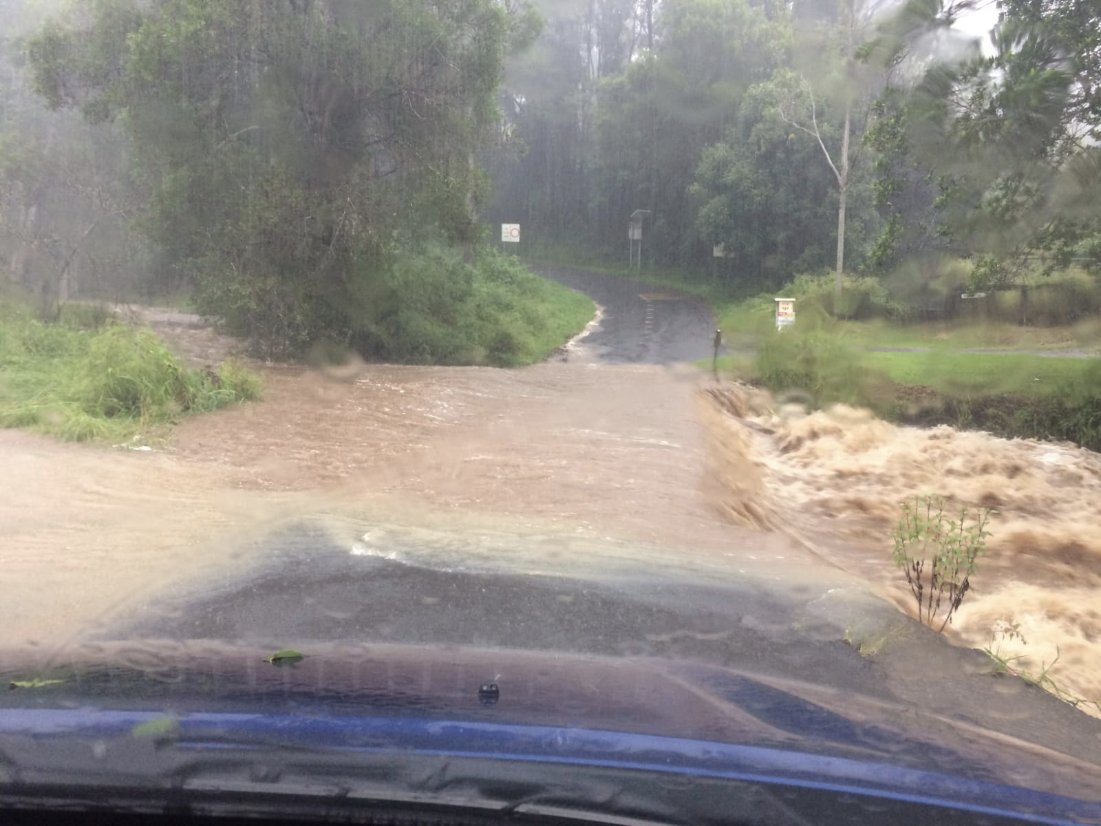
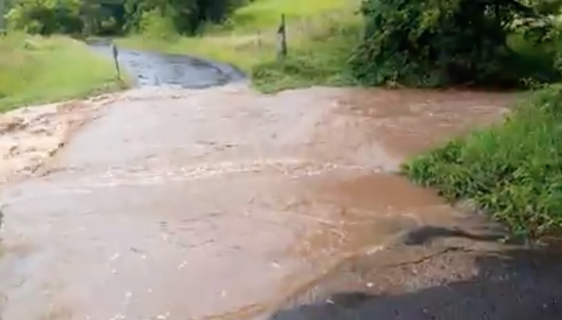
Photo left: Causeway near Tuntable Creek School. Photo right: Causeway near Arkinstall Rd.
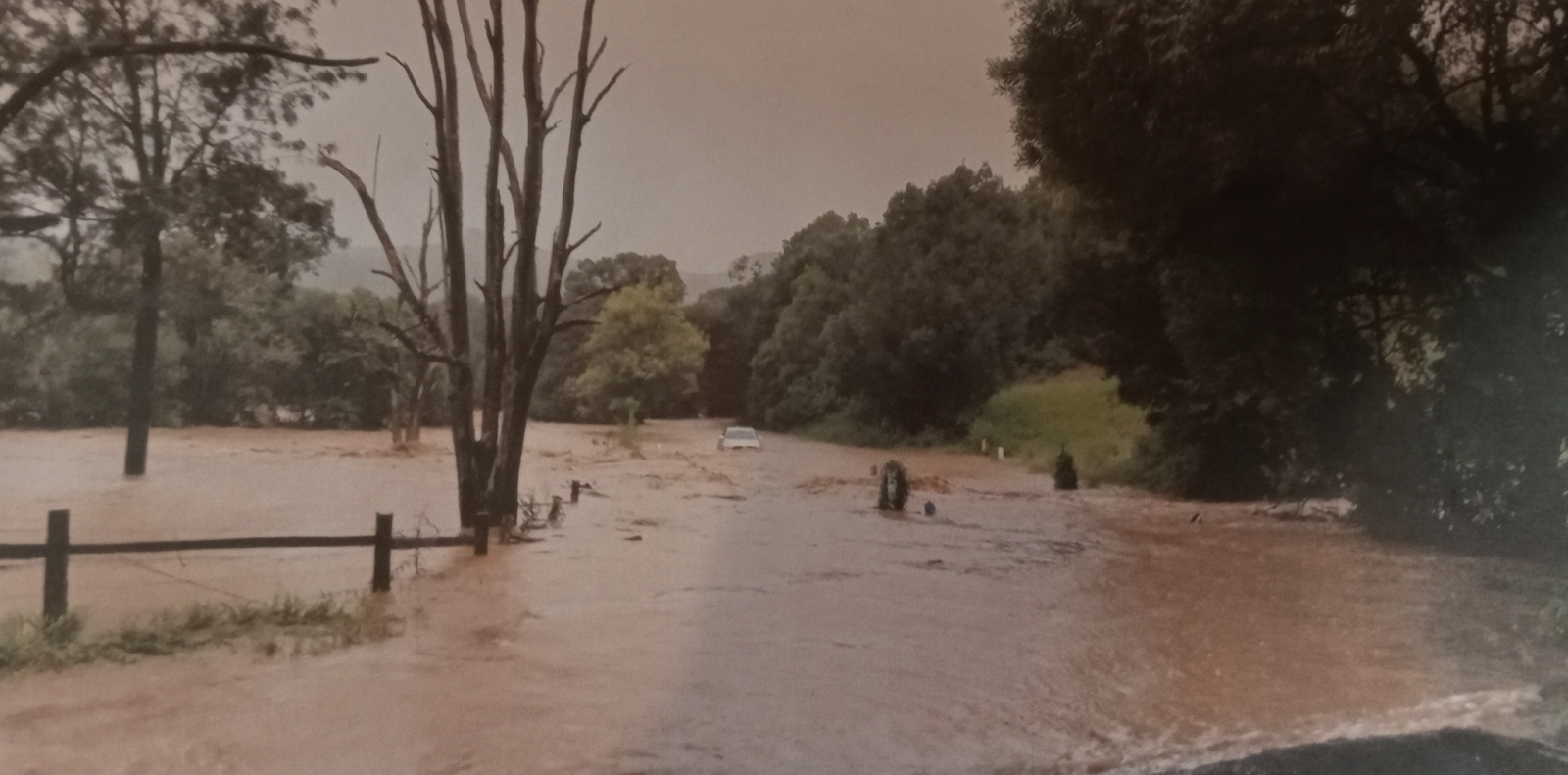
Photo: Causeway near Arkinstall Rd. Cars have been trapped here. Don’t be lulled into overconfidence by the flood staff at this crossing.
At The Channon Village
In major floods such as 2017, roads to the village become impassable. Near Coronation Park, Rocky Creek floods Robertson’s Bridge, cutting off the route to Dunoon Road. If you are in town checking the Terania creek height on BOM to get a sense of when to come home, be aware Rocky and Terania creeks have their own life (even though the Terania creek gauge is only 1.3km from Robertson’s Bridge). On 27/2/22 some people left their run too late and could not get home because Rocky creek was already over Robertson’s bridge.
Madman’s Gully is the big dip at the base of Nimbin St on The Channon Rd. This can become impassable during major floods, severing the route to Dunoon Rd and Keerrong Rd. Because Robertson’s Bridge can also flood, properties between Robertson’s Bridge and Nimbin St become isolated.
In 2017 flooding occurred on Terania St, impacting buildings closest to the creek. But the extreme flood of February 2022 was 2.18 metres higher than the major flood of 2017, and for the first time ever, water surged over Ford Bridge at the tavern. Homes, businesses and community infrastructure were flooded in low-lying parts of the village and residents had to evacuate to higher ground. Some improvements have been made to the hall so in future it can function better as an evacuation refuge.
We strongly encourage residents on low-lying property to get the phone apps and register for flood information as advised on Your Sources of Flood Information and to familiarise themselves with the content of these webpages. Residents adjacent to Rocky Creek in The Channon should register with Rous County Council for warnings about Rocky Creek Dam.
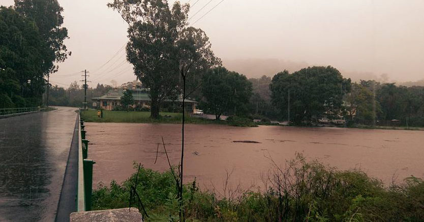
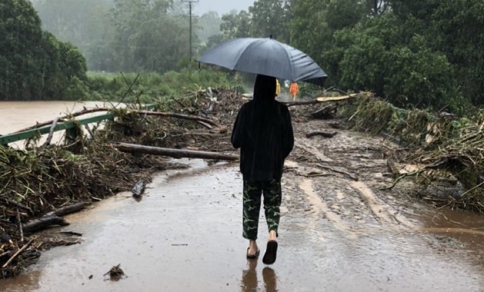
Photo left: In 2017 Terania creek reached just under the deck of Ford Bridge. Photo Right: At the peak of Feb 2022 water reached 1.55m above the deck of Ford Bridge and 55cm above the top railing.
Keerrong Valley
Problems with flooding in this valley have been known since 2017, when Terania creek spreads out on the Keerrong floodplain causing evacuations and stock deaths. At numerous places, water streams down the flanks of the valley, cutting Pinchin and Keerrong roads at road dips and culverts. There are few evacuation options, in many cases it’s a matter of going up driveways of elevated properties. It is essential that residents get the phone apps and register for flood information as advised on Your Sources of Flood Information. Residents on low lying property should register with Rous County Council for warnings about Rocky Creek Dam. It is important to inform new residents about this website, and to encourage them to read the pages relating to floods. New residents are vulnerable as they do not understand flood history, where to get information, or how flood warnings will work in the valley.

Photo: Keerrong valley in flood on 28/2/22, looking north towards The Channon. Photo by Chris Clark.
Understand The Difference Between Flood Warnings And Rocky Creek Dam Alerts
Rocky Creek Dam is managed by Rous County Council (RCC). All dams are governed by safety regulations and Rous constantly monitors the dam, its wall and the nearby spillway. During rain events, the level of the dam above the spillway is monitored in case it approaches the level of the dam wall. This has never occurred – but should it ever happen, there would be concern that water spilling down the other side could erode the structure. This is why warnings are issued when the spillway level reaches two trigger points. When water is 1m above the spillway, Rous advises the SES to issue an Amber Alert – prepare to evacuate. When water reaches 1.8m above the spillway, Rous advises the SES to issue a Red Alert – Evacuation order.

RCC keeps contact details of properties most at risk in the unlikely event of dam failure. During the February 2022 Red Alert, Rous staff phoned people on this list – but for many this call came too late for them to evacuate. This occurs because there has never been a holistic flood warning system that takes into account water coming down Tuntable, Terania and Rocky creeks. Those alerts we’ve had in the past about the dam may seem like they are flood warnings – but they aren’t! The amber and red alerts are specific to the risk of dam failure should water ever go over the wall. We are developing the Terania-Keerrong Flood Safety Project to improve this situation, so that people get proper flood warnings, delivered in time for them to get themselves and their livestock to safety. We will continue to work with RCC, the SES and Lismore City Council to better provide for flood safety here. In particular we look forward to Lismore City Council extending their focus beyond the city to include rural floodplains where people are at risk.
The Channon Resilience has asked RCC and the Bureau of Meteorology to show the spillway level in real time on BOM website. They have agreed to do this. When this is operational we will all be able to look at the levels and the trend, and to work out the rate-of-rise. The actual height of the dam wall is 3.2m above the level of the spillway. During the February 2022 flood the dam reached 2.4m. See Your sources of flood information for where you will be able to see the spillway levels, once this feature is operational.
Our Citizen Flood Knowledge Project – What We Are Learning
The Channon is a predictive gauge for Lismore – it’s important to know flood height to understand the catchment and likely future floods. In 2022, the creek gauge ceased functioning when it was submerged, so our community has determined flood height via surveying and optical level. We now know this was 14.32m (historical local measure) or 30.31 AHD (above sea level). If you look at this chart you’ll see it was 2.18m above any flood records here.
Our Flood Observation Project
A grant from the Northern Rivers Community Foundation enabled The Channon Resilience Inc. to conduct a project to gather community flood knowledge. See this short video.
This data is inportant. For the first time the SES will be giving flood warnings for our community – but to help them, we need to build knowledge of how volumes of rain translate to flood on the ground. From now on we encourage everyone to make observations during floods to build our knowledge – see our Citizen Flood Observers project. There you will find information about how you can contribute, and also the flood story we were able to build with data from our eagle-eyed community.
Landslides
High intensity rainfall causes landslides. During the February 2022 event this was extremely serious in the caldera, causing injuries and one death. Nearly every road around us was broken in some way. Please assess your risk for landslide – from above and at your house. Consider what you would do if this occurred. Could you alert people to your situation? By joining the CB Emergency Network you would be able to communicate if you are isolated or in danger from landslip.

The Feb 2022 event caused a major landslide on Tuntable Creek Road. This road was closed for almost one year.
National Park Closures:
When there is even minor flooding, the boom gate to Nightcap National Park gets closed due to a low causeway inside the park. A sign gets put up just past the preschool on Terania Creek Road saying “Park Closed”
YOUR SOURCES OF FLOOD INFORMATION
What To Do Now
Once a flood starts it may be too late to take some of these actions:

Hazards Near Me
Get the Hazards Near Me app on your phone. It will give you warnings about flood or fire risks.

The BOM Weather App
Get the BOM app on your phone. The BOM issues Flood Watches and Flood Warnings for rivers such as the Wilson. They also issue Severe Weather and Severe Thunderstorm Warnings for possible flash flooding, damaging winds, hail and heavy rain. You can also use this app to monitor incoming rain on radar.

Lismore City Council SMS Flood Alerts
Register for Lismore City Council SMS flood alerts. These alerts start when the BOM predicts that Lismore will reach minor flood level of 4.2 metres. To register fill in the online form here

Join the Channon hookups
Join your local Facebook group The Channon Hookups. Important information is shared here during floods and fires. Join other local Facebook groups near you.
Join The CB Radio Network
Consider joining The Channon CB Emergency Radio Network. If the internet and phone are down, we can provide flood information.

Update Your Flood Plan
Do you have a flood plan checklist and emergency kit ready? Resources are available on the SES website here
If your house is low-lying near Rocky Creek, and Terania Creek after the junction with Rocky Creek – ask Rous County Council to get dam warnings.
When an event starts – look for local infromation
Scan for information as the event develops. This is called situational awareness – it’s an active stance (rather than waiting for a warning). You can do this by:
Scan the BOM for official rain gauges (Terania, The Channon, Dunoon), and check the creek level at The Channon. Get used to navigating this NSW Rain and River Data site. When you look at creek levels – click on PLOT to see the graph – this shows the trend . Work out the rate of rise from the data. If it’s risen 90cm in 30 minutes – it could possibly rise 3.6 metres in 2 hours. When looking at BOM ignore ‘rising/steady/falling’…this is often misleading. If you are in Keerrong valley remember The Channon is quite close to you. NOTE: we have asked BOM and Rous to show Rocky Creek Dam spillway on the BOM site. When that happens we will all be able to see a graph of water levels rising on the spillway. This will make a big difference to situational awareness. See What you need to know about flood warnings for more on this.
Scan for rain information from our citizen rain sentinels. See Terania-Keerrong Flood Safety Project for how this works. When the BOM has issued a general warning, our citizen sentinels will start making frequent rain observations. We collate this information and send this to the SES. We also send an update to members of the CB radio network. We will also put this data on The Channon Hookups Facebook group.
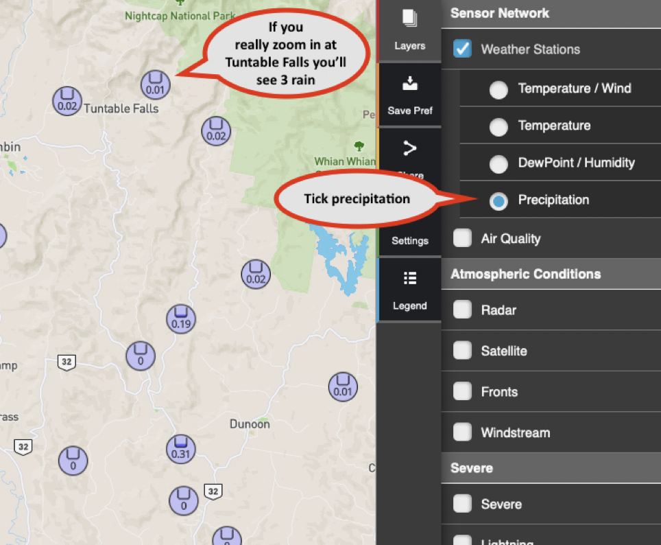
Scan Wunderground for automatic weather stations in the Terania catchment. If the internet is working this is a great resource…you can see rain data at Whian Whian, Terania, Tuntable Falls and The Channon. If you really zoom in on Tuntable Falls you’ll see 3 rain gauges up there. See Terania-Keerrong Flood Safety Project for more on how to see precipitation history on the gauges.
Use Local Facebook Groups such as The Channon Hookups – to ask what roads are clear, or let others know what is closed due to floodwaters. These groups can be fantastic for real-time reports. This only works if people state the Date, Time, and Location when posting photos. Remember to give updates when the water clears.
For information on major roads, contact Roads and Maritime Services on the 24 hour traffic enquiry line 132 701 or visit Live Traffic NSW at www.livetraffic.rta.nsw.gov.au
Preparation And Actions During The Flood
BEFORE
By now you will have downloaded the apps you need to stay informed. 🙂
If Your Property Is Prone To Flooding
-
- Store all chemicals and poisons above ground level in case of flash flooding.
- Identify which indoor items you will need to raise if flooding threatens your home (e.g. freezers, fridges, washing machines).
- Identify the most important farm equipment to move to higher ground. Have a plan.
- By taking simple actions to improve your home’s flood resilience of your home, you can avoid some heartache when the next big flood comes. See Simple solutions for home owners ( video).
- Renovating a room? Now’s your chance to do it with the new flood resilient materials and design. This means it’s a simple wash-down after flooding.
- Get out with a mattock and make sure your drains are clear – to save your road or driveway.
Contact Your Neighbours
Check out the excellent SES advice on the importance of neighbour networks.
If a flood event is starting, contact your low-lying neighbours to make sure they know how to get flood information. If they’re new to the area, link them to information on this website, and to The Channon Hookups Facebook group, where vital information will be shared. If you have a CB Radio let them know.
Council Map – Flood Prone Areas
Use this map to identify if where you are located is flood prone. Obviously flash flooding and heavy run off can occur not just where the main creeks are.

What About Your Animals
Make up an animal Evacuation Kit
Things to consider: feed, water, medications, rope/halters/leads etc, proof of ownership & vet records. Review your kit to ensure contents, especially feed and medicines, are fresh.
Tag your animals for identification
Make sure animals have some form of identification (microchip, ear/leg tag etc.).
Have a plan for where to take your animals during a flood
Often this will be on high ground at your neighbour’s place. It’s best to have an arrangement with them in case a flood develops when you are not at home. These people need to know your evacuation procedures, where your evacuation kit is kept, and have your emergency contact information. There are useful ideas in Dept of Primary Industries Livestock in Emergencies, RSPCA Disaster Information
DURING
Stay Safe During A Flood
The way to stay safe is to stay out of floodwater. People get into trouble at causeways because they assume the road surface is intact underneath the water – but it could be eroded. Once water hits the body of the car, it will start to drift – this is how people lose control.
Know The New SES Warning System
The new SES warning system has 3 levels. Check it out here.
Advice (yellow) – an incident has started. Stay up to date in case the situation changes.
Watch and Act (orange) – you need to start taking action now to prepare.
Emergency Warning (red) – you may be in danger and need to take action immediately.

If You Need To Evacuate
- Charge your phones and communication devices.
- Pack warm clothing, essential medication, valuables, personal papers, photos and mementos in waterproof bags, to be taken with your emergency kit.
- Raise furniture, clothing and valuables (electrical items highest).
- Turn off electricity, water and gas / take your mobile phone, CB radio and chargers.
- Put sandbags in the toilet bowl and over laundry/bathroom drain-holes to prevent sewage back-flow.
- Remember your pets.
- Lock your home and take the safest evacuation route, which may be up your neighbour’s driveway .
- Never drive into water of unknown depth and current.
- Tell your family or neighbours and keep them informed as to where you are.
If You Remain In Your Home – Or When You Return
- Keep your emergency kit safe and dry.
- Do not eat food that has been in contact with floodwater and boil all water until supplies have been declared safe.
- Don’t use gas or electrical appliances that have been flood affected until they have been safety checked. Do not handle wet electrical equipment.
- Beware of snakes and spiders that may move to drier areas in your house.
- Avoid wading, even in shallow water as it may be contaminated.
- Be aware floodwater may be contaminated – wear solid shoes or boots for protection.
- Use betadine (or other antiseptic) on broken skin.
- Keep listening to your local radio and follow warnings and advice.
-
Make sure family & friends know you are safe. In major disasters, be aware of the Red Cross Register-Find-Reunite service.
AFTER
DISASTER RESPONSE AND RECOVERY
THE CHANNON HALL EVACUATION CENTRE
After the 2022 flood our self-organising community ran an emergency centre from the hall for seven weeks. Lismore City Council now recognises The Channon Hall as an emergency evacuation centre in times of disaster. The Channon Resilience Inc will call on volunteers to help with this, so please chip in with your goodwill and energy! At the height of a major flood most people will not be able to reach the village and these people will need to seek higher ground with neighbours during the immediate flood emergency.
LISMORE CITY COUNCIL
Council has an excellent page for recovery services including support for farmers, wellbeing support, financial and legal advice and assistance, rebuilding and repairing, flood recovery hubs and support services and more.
RESILIENT LISMORE
Resilient Lismore is a community-led organisation that helps with recovery from disasters. Please check out their website, in particular the page that lists support services and resources.
Emergency Contacts
For Urgent Emergency Help
phone Triple Zero 000
For Flood Or Storm help
Phone SES on 132 500
For Loss of power
electricity problems or fallen
powerlines contact essential
energy on 132 080
To Register for SMS flood Alert
Call Lismore City Council on
1300 87 83 87 Or Visit
www.lismore.nsw.gov.au
Download the BOM app.
Keeping an eye on the weather is the best way to stay informed this app makes it easy.
Join the Channon hookups
Facebook group to connect to our community as well as get regular updates on what is going on.