The Channon life

A brief context for The Channon landscape
The landscape we see around us was formed primarily by the Wollumbin (Mt Warning) volcano which last erupted about 20 million years ago. Modern humans evolved about 2 million years ago.
Humans arrived here about 40,000 years ago. They managed and cared for the landscape in a steady state system for many, many generations. The Channon and Surrounds sits within the boundaries of the Widjabul Wia- bal people of the Bundjalung Nation, the traditional custodians of this area.
White settlers arrived in The Channon area about 1900, only 120 years ago! They transformed the landscape first to an agricultural system and now to an increasingly urban system based on progressive growth of population and use of resources. This is the challenge we now deal with.
Where did the name The Channon come from?
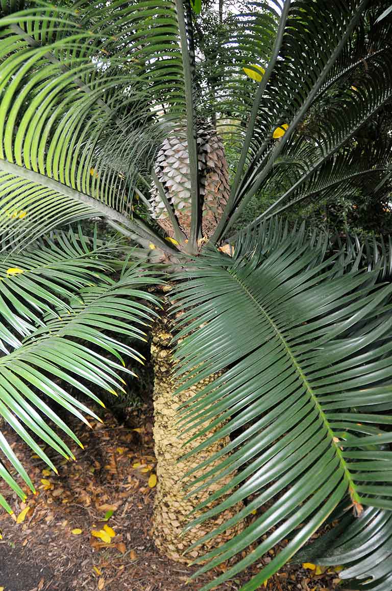
The Channon, pronounced “CHANNON” (English-ised from a local aboriginal term for the Burrawang palm “Djaning”, a type of cycad that proliferates along the ridgelines in the area.
To be clear, locals call it The Channon (not The Shannon)!
What area does The Channon & Surrounds cover?
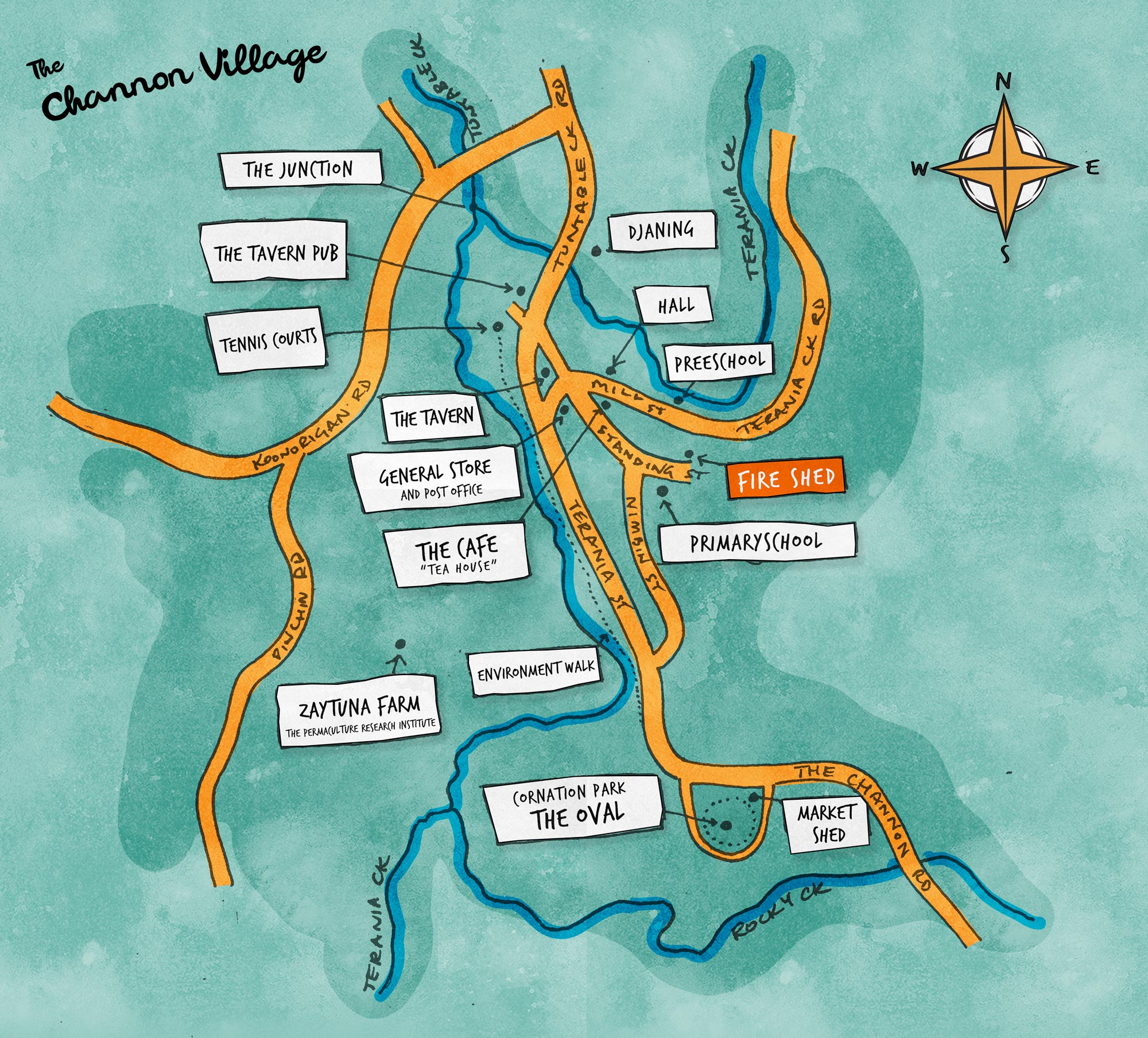
The Channon and Surrounds community comprises The Channon village and surrounding communities, as shown on the map.
This map indicates the area and loosely represents the location that The Channon Disaster Resilience Plan applies to in the event of a disaster. While it does provide an estimated location where the community lives, works and visits, it is acknowledged that these are loose edges where people outside that ‘map’ still identify as being part of The Channon community. (map from council with dotted line )
Our community lives south of Nightcap National Park, approximately 18 kilometres south/ south-east of Nimbin and 25 kilometres north of Lismore town centre, in an area of over 60 square kilometres. The land is made up of a variety of rural interests, including grazing and cropping, environmental protection as well as intentional communities.
The Channon and surrounds is home to iconic landscapes, environmental attributes and a sense of community and identity that sets us apart. These unique attributes go to the very heart of who we are and form a significant part of our individual and collective community values.
Map of loosely defined ‘The Channon & surrounds” area

The Channon Village
Core community assets & businesses
Please note: This page and other sections of The Channon Life will be exanded and added to.
Get to know our village
Get to know our village
(Info and contacts in Local Directory)
The Channon Hall
The Channon General Store (“The Shop”)
The Channon Tavern (“The Pub”)
The Channon Primary School
The Channon Children’s Centre (The Preschool)
The Channon Cafe (The Teahouse)
Coronation Park (The Oval)
The Market Shed
The Common
The Channon RFS Shed
Tennis Courts
Djaning
Zaytuna Farm (Permaculture Institute)